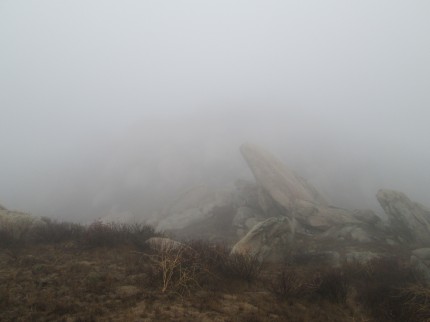
Rather than just hike the same 6.5 miles today, I thought I would pick up a few geocaches along the way. As for the day, the weather was forecast to have a 20 percent chance of showers and fog. As I headed to Box Springs Park, there was not a lot of drizzle, but there was a lot of fog.
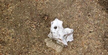
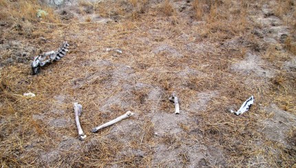
I began on the Two Trees trail as usual and headed uphill to the park entrance. I was getting a little wet, however, it was less than if I put my rain gear on as I was definitely warm. Once to the upper parking lot I headed up the road to the Spring Trail. On the spring trail I came across piece of vertebrae. I also looked around and the visibility was poor.
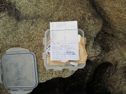
I continued past the spring and up the trail further as I was going to then cut back the other direction and head uphill towards the first geocache. The geocaching application on my phone usually gives me a map. However, there was no cell signal so no map. I did have the cache location stores so I made my way to the cache location. The cache was easy to find because it was sitting out in the open on a rock. I simply took the lid off and signed the log.
Once the cache was sealed up and hid under the rock at the same location, I was ready to move towards the next geocache. Little had I noticed, it became a lot foggier. Visibility was about 50 feet. The map on my geocaching application was not working. I was on the ridge of the mountain and could not see anything.
I turned to my GPS application, View Ranger, which I have loaded maps into. I know where I am on the GPS so I pick a direction and start heading off. The problem is that the detail on the map is not really good. It does not show every small peak and rock outcropping. I keep looking at the view ranger application and notice that I am headed too far East to get to the next cache. I look at my location, which still has very limited visibility and pick a new direction. I go for about a hundred feet and I am headed the right direction. I continue on. I check again and I have circled around a small peak and I am headed East again.
To add to the situation, it began to drizzle, visibility was getting worse and the wind was picking up. I thought to myself, I am getting cold. I stopped and put on my Marmot shell to keep me dry and keep the wind off me.
So much for orienting the GPS based on what I was seeing. I decided to break out the compass to make sure that I can get the direction of travel that I need to go. I needed to go due South . I started to head South following game trails and run into a giant forest of chest high vegetation. I still cannot see any landmarks to target so I work my way around the vegetation. In doing so, I throw off my line and am going to end up on the wrong side of the next peak. I make the corrections in direction and keep moving.
I know I am not lost, I am just slightly disoriented in making my way to my next target. If I wanted to get back to the road I would head west, so I am comfortable with were I am at. Just frustrated that I cannot get a bearing far enough out to keep on target. Fifty feet of visibility is not fun when following game trails. As I am making my way up towards a small saddle between two peaks or rather large rock outcroppings where I will start to make my decent I ran onto a few parts and pieces that gave me a little surprise.
At least by then I know I was headed in the right direction. If I had been wandering in circles for an hour I would have thought differently. As it was I was heading downhill to a geocache called Rocky Point Cache. I could tell by the distance to the cache and by the terrain, where the rocky point was.
The cache was easy to find and I was then on my way up the road to the radio towers. I was surprised that I could hear the air conditioners for the transmission equipment for one of the tower’s and I could barely see the building much less the tower sticking up in the air. As I got closer, it was kind of eerie that I could see the bases of the towers and they just disappeared into the clouds.
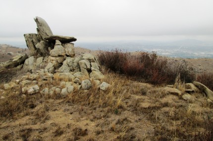
I soon came to the Ridge Trail and began my decent towards the last geocache that I planned on getting today. I had a pretty good idea of where it was at. I hiked to the location and turned on my geocaching application. It said that I needed to travel 100 feet south. I made my way up off the trail and there it was, Devils High Chair. It was rather obvious.
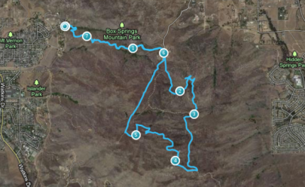
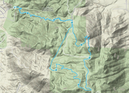
I grabbed the cache from the chair, signed the log, returned it and headed back to the trail. From there it was down the trail to the road, up the road a bit to the Edison Trail. I zipped down or rather up and down the Edison trail to the parking lot and then headed down the Two Trees trail to where I parked. You can view the path below. You will notice that between mile two and three I went west to get the geocache and then had a little trouble getting the righ track to the next cache which was about mile 3.
Overall, it was a good day. I learned that it is not hard to get a little disoriented. The trail started at 1237 ft and the high point was about 2858 ft. Who would have thought hiking above 2000 feet would be in the clouds. I will wait for a clear day to go geocaching next time in Box Springs Park.

