November 2024
M T W T F S S
 123
45678910
11121314151617
18192021222324
252627282930  

Geocaching Box Springs Park

Rather than just hike the same 6.5 miles today, I thought I would pick up a few geocaches along the way. As for the day, the weather was forecast to have a 20 percent chance of showers and fog. As I headed to Box Springs Park, there was not a lot of drizzle, but there was a lot of fog.

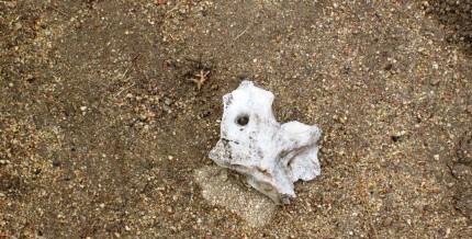
I began on the Two Trees trail as usual and headed uphill to the park entrance. I was getting a little wet, however, it was less than if I put my rain gear on as I was definitely warm. Once to the upper parking lot I headed up the road to the Spring Trail. On the spring trail I came across piece of vertebrae. I also looked around and the visibility was poor.

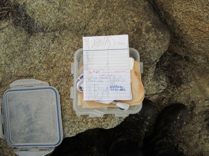
I continued past the spring and up the trail further as I was going to then cut back the other direction and head uphill towards the first geocache. The geocaching application on my phone usually gives me a map. However, there was no cell signal so no map. I did have the cache location stores so I made my way to the cache location. The cache was easy to find because it was sitting out in the open on a rock. I simply took the lid off and signed the log.

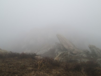
Once the cache was sealed up and hid under the rock at the same location, I was ready to move towards the next geocache. Little had I noticed, it became a lot foggier. Visibility was about 50 feet. The map on my geocaching application was not working. I was on the ridge of the mountain and could not see anything.

I turned to my GPS application, View Ranger, which I have loaded maps into. I know where I am on the GPS so I pick a direction and start heading off. The problem is that the detail on the map is not really good. It does not show every small peak and rock outcropping. I keep looking at the view ranger application and notice that I am headed too far East to get to the next cache. I look at my location, which still has very limited visibility and pick a new direction. I go for about a hundred feet and I am headed the right direction. I continue on. I check again and I have circled around a small peak and I am headed East again.

To add to the situation, it began to drizzle, visibility was getting worse and the wind was picking up. I thought to myself, I am getting cold. I stopped and put on my Marmot shell to keep me dry and keep the wind off me.

So much for orienting the GPS based on what I was seeing. I decided to break out the compass to make sure that I can get the direction of travel that I need to go. I needed to go due South . I started to head South following game trails and run into a giant forest of chest high vegetation. I still cannot see any landmarks to target so I work my way around the vegetation. In doing so, I throw off my line and am going to end up on the wrong side of the next peak. I make the corrections in direction and keep moving.

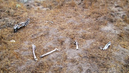
I know I am not lost, I am just slightly disoriented in making my way to my next target. If I wanted to get back to the road I would head west, so I am comfortable with were I am at. Just frustrated that I cannot get a bearing far enough out to keep on target. Fifty feet of visibility is not fun when following game trails. As I am making my way up towards a small saddle between two peaks or rather large rock outcroppings where I will start to make my decent I ran onto a few parts and pieces that gave me a little surprise.

At least by then I know I was headed in the right direction. If I had been wandering in circles for an hour I would have thought differently. As it was I was heading downhill to a geocache called Rocky Point Cache. I could tell by the distance to the cache and by the terrain, where the rocky point was.

The cache was easy to find and I was then on my way up the road to the radio towers. I was surprised that I could hear the air conditioners for the transmission equipment for one of the tower’s and I could barely see the building much less the tower sticking up in the air. As I got closer, it was kind of eerie that I could see the bases of the towers and they just disappeared into the clouds.

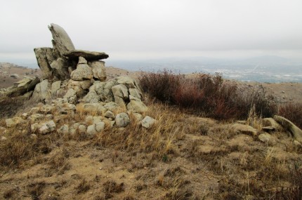
I soon came to the Ridge Trail and began my decent towards the last geocache that I planned on getting today. I had a pretty good idea of where it was at. I hiked to the location and turned on my geocaching application. It said that I needed to travel 100 feet south. I made my way up off the trail and there it was, Devils High Chair. It was rather obvious.

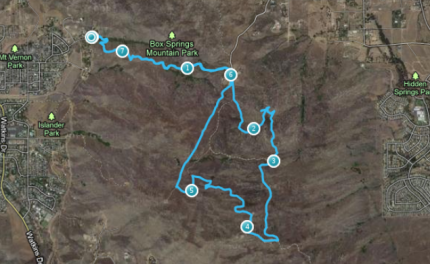
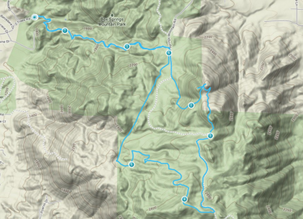
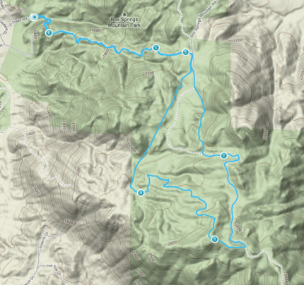
I grabbed the cache from the chair, signed the log, returned it and headed back to the trail. From there it was down the trail to the road, up the road a bit to the Edison Trail. I zipped down or rather up and down the Edison trail to the parking lot and then headed down the Two Trees trail to where I parked. You can view the path below. You will notice that between mile two and three I went west to get the geocache and then had a little trouble getting the righ track to the next cache which was about mile 3.

Overall, it was a good day. I learned that it is not hard to get a little disoriented. The trail started at 1237 ft and the high point was about 2858 ft. Who would have thought hiking above 2000 feet would be in the clouds. I will wait for a clear day to go geocaching next time in Box Springs Park.

Green House Gasses

It was a pleasant surprise when I cam home tonight to find the children were creating green house gasses in honor that global warming stopped 16 years ago.

Of course there was a haze in the kitchen due to the making of french fries. The haze was promptly transported outside along with the aroma, a fitting tribute to cooler weather . . .

Global Warming Stopped 16 Years Ago

Yes it did. All the information is available here. So do I get to ask why I pay more for energy because a group of “Chicken Little’s” had to scream, “The red stuff is going higher in the glass tube.”

I think I will have to stoke up the BBQ this week and emit some greenhouse gasses . . . Perhaps more than once.

Two Trees Trail – again

Today I was off the the Two Trees trailhead again. I skipped last Saturday to do a few things around the house. I hiked the same path, up the Two Trees Trail to the road and then up the Spring trail to the road and then up the road to take the Ridge Trail down to the road to get to the Edison Trail which takes me back to the Two Trees Trail.

Three weeks ago the time was 2 hours and 53 minutes. Two weeks ago the time was 2 hours and 42 minutes. Today the time was 2 hours and 34 minutes, 8 minutes faster. I was either faster, or take less pictures. The only picture I have for this week is from the bottom of the Two Trees Trail. I was coming down and a cool breeze was blowing through the area. It felt great. As for the foliage, the leaves on the sycamore tree are starting to turn and fall. As for all the poison oak, in the unprotected areas, they leaves have started to turn. As for this area, the poison oak is very much green and well. This part of the trail is the only place that any shade can consistently be found. Up the trail is through the typical no tree type of landscape.

Hiking for Fall - Aspen Groves

For several years now I have wanted to visit the Aspen Groves where quaking aspen (Populus tremuloides) could be found in the San Gorgonio Wilderness. Should I say, for almost 20 years. Many years ago we visited the ranger station to get a day hike permit. There were no more permits for Aspen Grove so we choose to hike out of the Fish Creek trail head on the Fish Creek Trail.

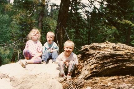
Emily, Eric and Scott on the Fish Creek Trail

I planned on going to Aspen Grove this Friday. I wanted to see some fall color here in Southern California. My plans changed when I learned that it was going to possibly snow Wednesday night and probably would Thursday night. Wind, rain and snow tend to remove fall colors. I also should mention that I visited the blog of Hikin’ Jim where he detailed his visit to the Aspen Groves this past Sunday. His blog lets us know that aspens are not normally found this far south. They kind of hung around after the last ice age.

With the quick plan change, I asked Scott to go with me. The plan was to work half a day and then head to the mountains. We stopped at the Ranger Station and picked up the needed permit to enter the wilderness. We reached the Aspen Grove trail head and Scott and I stared down the trail. O how I love going downhill in the beginning so I can hike uphill at the end. As we came down the trail we came across Fish Creek. The same Fish Creek that is just over three miles south where you can find the Fish Creek trail head.

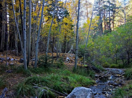
Fish Creek in the Aspen Groves

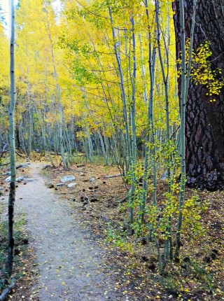
As the trail crosses the creek, you have two choices, going North or South. We decided to head down the trail going North towards the largest grove of aspens. The hike was on fairly even terrain at first. We also noticed that there were many fallen leaves at this time.

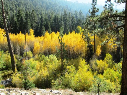
As we hiked North we passed several small groups of aspens. The trail seemed to go up and down as it made it way around the creek. We also crossed Fish Creek a few times. Soon enough, in the distance we could see what looked like a large grove of aspens.

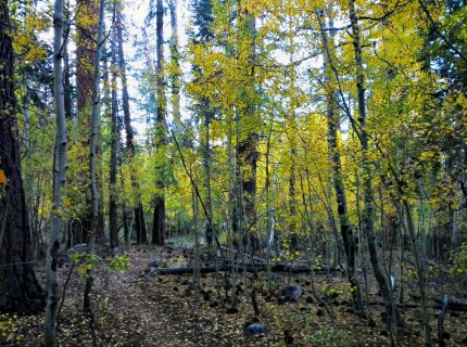
part of the large grove of aspens

We continued down the trail not knowing if we would find any more large groves of aspens. When we were convinced there were no more aspen groves to be found, we turned around and and headed back south. We decided to stay on the west side of Fish Creek rather than cross over with the trail. We made our way carefully to avoid hurting any plant life as we made our way up towards the grove.

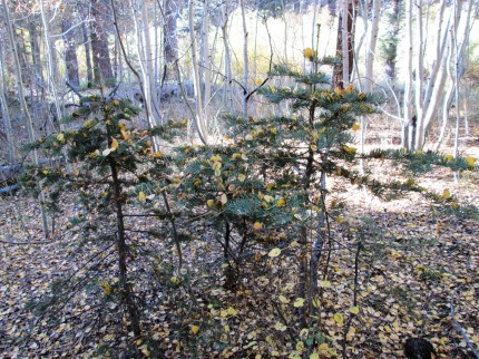
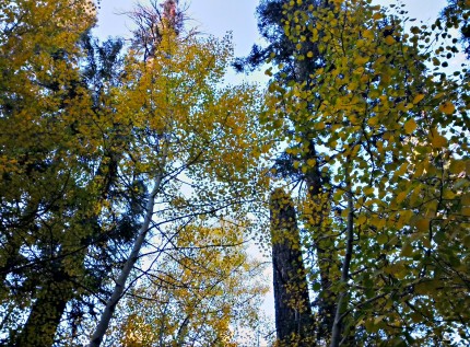
Being under the trees is not as wonderful as looking at them from the outside. Unfortunately, there were several smaller aspens that did not fair very well this year as it has been hotter and dryer than the previous few years. We did find some small white fir trees that had been decorated with golden ornaments from above.

We were ready to head out so we made our way back to the trail.

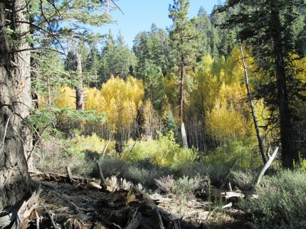
We took a few more pictures of the large grove of aspens as we headed back up the trail.

Once back at the junction we decided to take the trail that heads south towards the Fish Creek trail head.

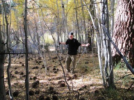
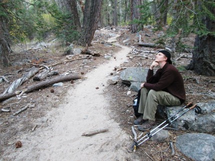
We hiked about a mile before we took a short break. Scott wanted to have his picture taken while pondering. I did not ask him if he was pondering anything other than his pose.

As we were resting a hiker came down the trail. I asked if there were any more aspen groves up the trail. The answer was no. However, we were told that it was beautiful up the trail and that we should hike up to Fish Creek Camp. I thought, I have been past there several times and I do not need to hike 3.4 miles or more to that camp and back the 4.6 miles back to the car. That is 8 miles. It is getting cold and soon to be dark. Did we have the gear to hike in the cold and dark? Yes. We just did not have the desire.
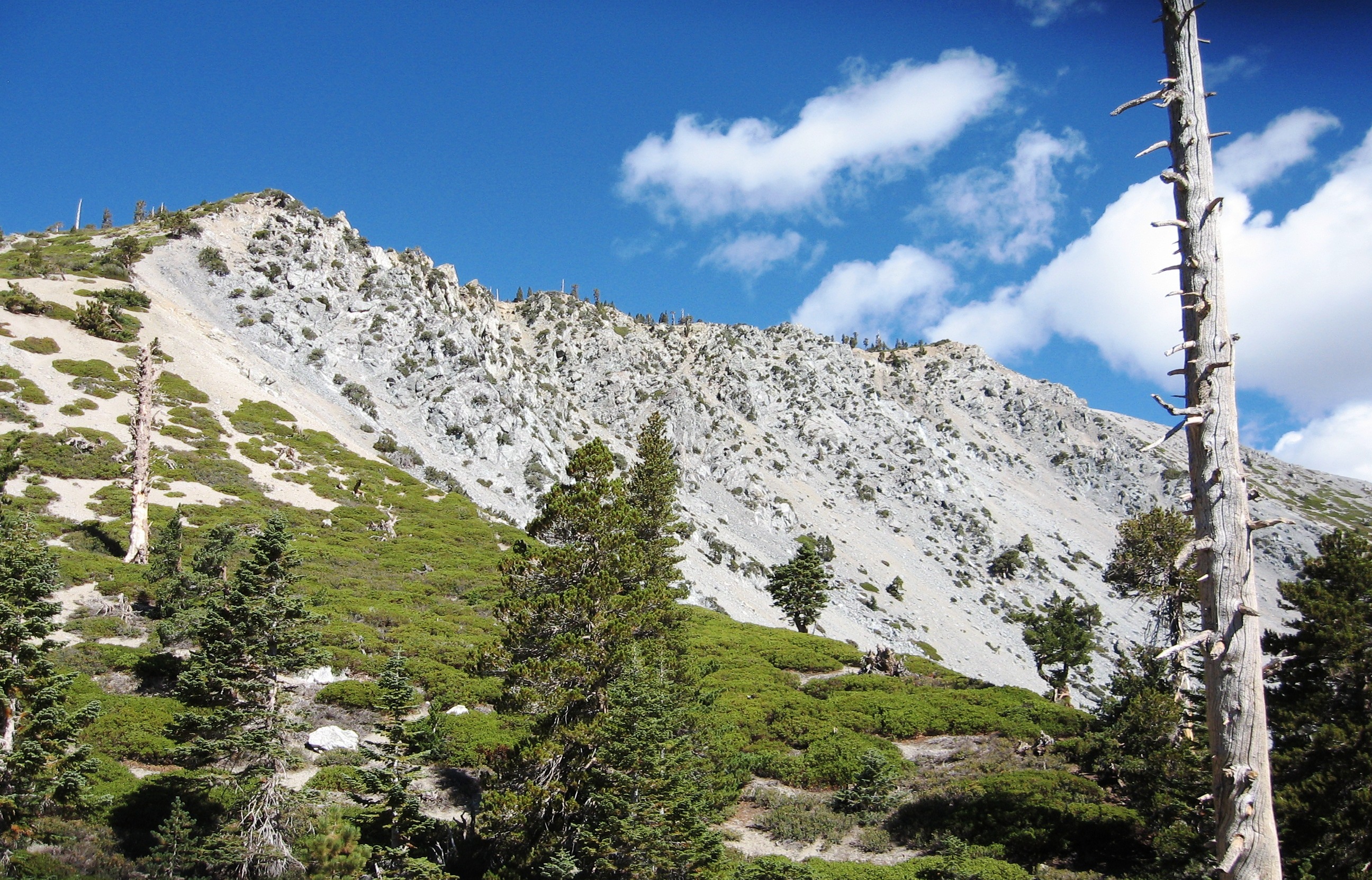
We soon turned back and headed to the trail head. We did stop and look at the golden colored leaves of the aspen trees on our way down the trail.

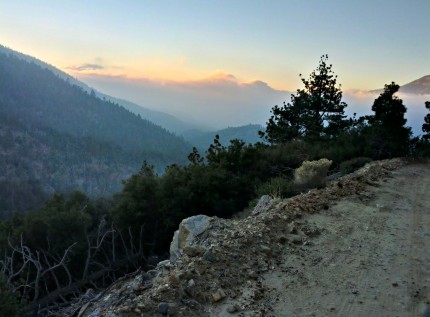
Once to the trail head we hiked north at a higher elevation to see if we could find the grove. We did, but there were a lot of trees between us the the aspen grove. We then headed higher up the dirt road in the truck to get a view from an even higher elevation. We could see the sun getting masked by the clouds as there were making their way up the valley and over the tops of the mountains.

This afternoon of hiking reminds me that fall is upon us. The days are shorter and the evenings are cooler. There may even be some snow at the higher elevations after this weekend.

Patriotic Video

I came across this video of The Star Spangled Banner by Madison Rising and thought I would share it.

Happy Birthday Emily

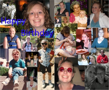
My little girl turned 23 today. This year has been a big year for her as she is now a mom. It is amazing how fast they grow up. I took some time and made a card covered with pictures from the past.

Two months old – Cuter than a bug . . .

Elizabeth is officially two months old. More smiles are being found and there is more activity. She is leaving the world of newborn sized clothes as she fills them out now. As for the ladybug blanket she is on, the material came from Grandma Brown and it was beautifully crafted my my Aunt who makes blankets.

As for Elizabeth, she likes going on walks in the stroller. There is always a lot to see. Laying on a blanket outside is always fun as well. We will have to see what happens over the next month.

Cuter than a bug . . .

Box Springs Park - Ridge Trail

This morning I took the same route as last week. I started a little earlier as there was no cloud cover. The sun also is a little slower at getting up into the sky so I was greeted by more shade on the way up the Two Trees trail. The Spring Trail, being on a western facing slope also had some shade. However, from then on out, it was sun all the time.

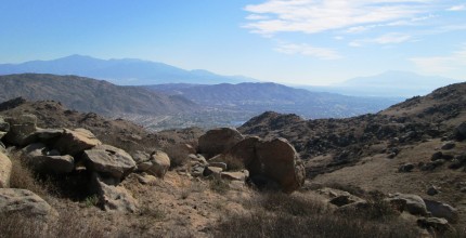
Today I took a picture of Mt. San Gorgonio and Mt. San Jacinto in the east. The perspective was a little different than I an used to as I am usually lower in elevation and more to the North or South as Box Springs mountain blocks the view of either unless you are further West.

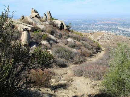
On of the things last week that intrigued me was the rock formation coming down the Ridge trail. Much of the rock is close to perpendicular to the horizon. You get used to seeing the strata in the rock being horizontal. In fact, strata is several layers of material layered on top of each other. In places the trail is going across the edge of the strata. The rocks show their strata and are weathered which accentuates the layers. Especially, when the layers appear close to vertical.

As for the hike I was 11 minutes faster than last week on the 6.25 mile hike.

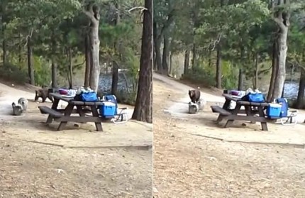
Bear steals iPad

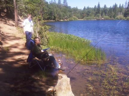
I have fished at Jenks Lake. I have hiked in the mountains around Jenks lake. I have spent a week at Scout Camp near Jenks Lake several times.

Fishing at Jenks Lake in 2009

Yes we had bear problems at Scout Camp if we left smellables out. So yes there are bears in that part of the forest and they like food. Moral to the story is do not put your iPad in the same day pack as your granola bar. The full story can be found here. The only question is, did the owner of the iPad have the music track to Country Bear Jamboree on his iPad?

Election Season Humor

Via Shall Not Be Questioned

Mt Rubidoux – Sunset

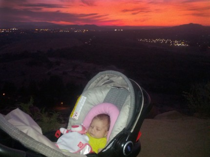
Tonight Emily, Elizabeth and I went out for a walk. The goal was to make it to what I call the windy place. As you go up the down road, you reach a point where you are on the west side of the small mountain. I always liked to stop there because it is one of the only places that feels like there is a little air conditioning.

Elizabeth was awake for most of the walk. As we were reaching the windy place, she began dozing off. She may not be able to enjoy a sunset yet, but we did enjoy the view.

Mt Rubidoux – almost

Tonight Emily and went on a walk to the entrance of Mt. Rubidoux. I have a geocache there that went missing. Elizabeth went on the walk with us. The evening was warm and by the time we got to the gates, which is about a mile away from the house, she was a sleep.

Morning Hike – Ridge Trail

Today I took my traditional hike up Two Trees trail and then up the Spring Trail. Rather than heading down the road at the end of the Spring Trail, I headed up. After getting close to the top of the ridge I followed one of the roads to one end of the Ridge Trail, marked as Horse Trail. As most of the trails are off limits to horses, this one is not.

Looking West from the road from the upper end of the Ridge Trail where it begins just to the left of the picture

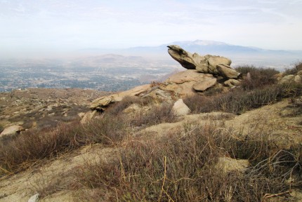
I had to take a picture of Downtown Riverside, a rock and the Cucamonga Peak off in the distance. As for the route, I have included a map below. It was a 6.25 mile trip in under 3 hours. The trail head started at an elevation of 1,237 the high point was 2,867. It was a good hike and I enjoyed it.

The Pirate - Robbing from our children . . .

This morning I posted about International Talk Like a Pirate Day. I thought it was a cute idea. Little did I know that with all that is going on in the world, our President would rather talk to a pirate and tell the world he has no time for Netanyahu. I guess the word for this evening is Rrrrrrrrrrrrrrrrrrrrrrrr . . . Romney – NOT OOOOOOOOOOOOOOOOOO how I rob from you and your children Obama. Now for the picture that speaks louder than words from his twitter found here.

NOT Lead Rrrrrrrr ship. Just more O