|
|
The weather has been warmer and the sun is out later so there is a plan to sail more often. Sitting in a sail boat in light wind is not a very good cardio exercise so I will have to balance diet, exercise and sailing. Then again, keeping wind in the sail takes thought and may sharpen the mind.
 Sailing on Lake Evans
Today was another training hike for Philmont. Unfortunately, the only young man that could make it was Jacob. Emily was going to go as well, you know, for the exercise. We got a late start and left the house at 6:45 am. We were crunched for time because lunch was going to be at the company picnic. It really was a difficult time line.
We made it to the Mill Creek Ranger Station to drop of Emily’s car and then head up the mountain. We made it to the trailhead at 7:45. I got out of the truck to get out the hiking poles and day packs. Jacob and Emily got out momentarily and jumped back in. I was in shorts and it was a little chilly. They were in long paints and thought it was down right frigid. I packed Emily’s day pack with one of my jackets. She grabbed the day pack and quickly put it on. However, I knew, once we hit the trail we would warm up.
 A hundred yards up the trail and coats are still on There were plenty of switchbacks in the beginning to get warmed up on. The coats soon came off and Emily commented on how good the breeze felt. I had figured 40 degrees was good hiking weather for shorts and I turned out correct. However, at the trailhead I noticed that everyone was in long paints.
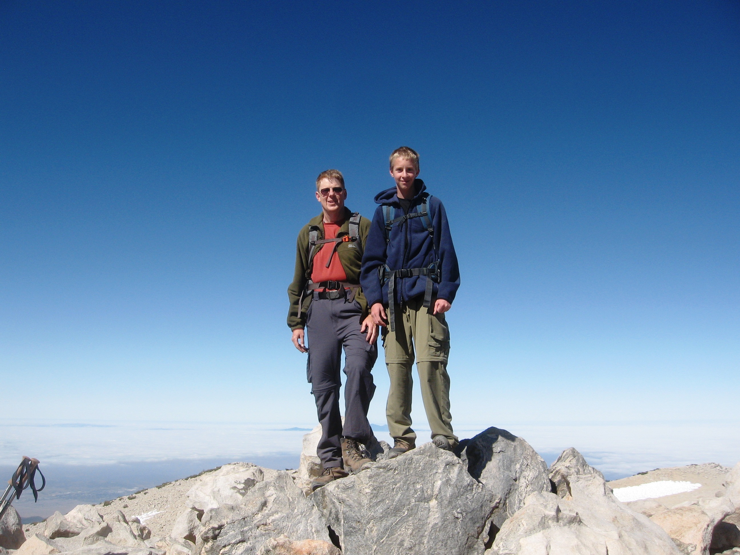
We made out way to the wilderness boundary and it was time for a group shot. There was a nice rock ledge that would hole the camera.
 San Gorgonio Wilderness Boundary on the San Bernardino Trail We were making fairly good time. Jacob had been taking plenty of pictures and both Emily and Jacob were texting. The also walked faster than I did so they would take the opportunity to take time to send text messages or post something to Facebook.
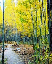
 Log of Communication - AKA the Texting Log Soon we were traveling across some fairly flat terrain. Lots of manzanita and Ceanothus cordulatus, also known as Mountain Whitethorn. In places the trail was so narrow that hiking poles could not be used and the Mountain Whitethorn simply left scratches on the legs of those in shorts. It was convenient that the sometimes the Mountain Whitethorn was only on one side of the trail. It just waited for me to come back down to attack the other leg.
 Mountain Whitethorn on the left and a nice soft plant on the right The snow showed up above 8,000 feet in elevation in shady places. On the north faces, there was more snow. At the end of one switchback we encountered a bench where I took a picture of Emily and Jacob. The elevation was about 8,800 feet.
 A great bench to rest on in the middle of the wilderness We made it through the patches of snow on the trail to where the trail was less snow covered. We passed the Lumber Pine creek which flowed from Limber Pine Springs. We could see Mt Baldy towards the west and the valley below. You can click on the pictures to make them bigger. Mt. Baldy has some snow on it in the distance.
 The view towards the west at 9,000 feet up We were in search of the San Bernardino Mountain Initial Point. Colonel Henry Washington established the initial point of the San Bernardino Base and Meridian at the summit of Mount San Bernardino in November, 1852. The monument is the starting point for sectional subdivisions for all the land in southern California. More information on that is available here.
We were running out of time to make it back to the company picnic. We asked some people coming down the trail, how much further. The response, not much further to Limber Pine Bench but due to lots of snow on the trail, it will take some time. It was 11:00 and the food was being served at 1:00. We had traveled on the trail for over three hours and that left us a short amount of time to get back. It would take about a half hour to get into Yucaipa from the trailhead as well. The people we were talking to said, you better get going. We hiked and ran the best we could and made it back to the truck at the trailhead at 12:45, about half the time it took us to get up the trail to where we did.
We made it to the Yucaipa Regional Park and as we were making our last left turn into the group picnic area, lo and behold Jacob said, “We hiked all that way to find that place and it is here in park.” Sure enough there was a replica of Colonel Henry Washington’s Initial Point. We ate lunch and I said, hey lets walk over and take a picture of the monument. You can see the replica of the 25 foot tall initial point as well as San Bernardino Peak in the distant background where the actual Initial Point really is.

In the continuing quest to become a lighter weight on mother earth and prepare for this summers trek in New Mexico, a few friends and I went on an overnight backpacking trip. This weekends trip was to Dry Lake for the night and a day hike for the younger and more adventurous to the peak of Mt San Gorgonio.
We left the city and fought our way through the holiday traffic. We made it to the South Fork trailhead. We then began the 7.1 mile trip to Dry Lake.
 On the trail to Dry Lake It was a warm afternoon and as the sun moved lower in the sky the air became cooler. It was also fairly breezy which felt good. The sun set and it became twilight as we moved further up the trail. Within a quarter mile of Dry Lake we came upon patches of snow on the trail. We then came upon a group of girls camped in a spot that they should not be. As they were cooking dinner they heard a bear. It was about the same time that I was telling Bret, who I was hiking with about Eric E. and his bear impersonation on our adventure last year. They were grabbing their food, protecting their dogs and scared to death that this bear was going to get them. About then, we saw Greg S. and I asked is “Eric the Bear” around. The answer was yes. Eric showed up, apologized to the girls and helped them hang the remainder of their food in a bear bag as their bear canisters were full.
Upon arrival, we made camp and cooked dinner. The wind was still blowing. Oh, how I have never been able to sleep well when the wind is blowing. Everyone was in a tent except for me. I slept on the ground and had a great view of the stars. It was a beautiful evening.
The next morning came too soon. I was up just after 6 and started some after to boil some water so I could make my breakfast. Camp was fairly quiet. A few were up, but several were still in their tents.
 Camp next to Dry Lake After breakfast and packing up Bret and I took a walk around Dry Lake. It was a gorgeous day in the San Gorgonio Wilderness.
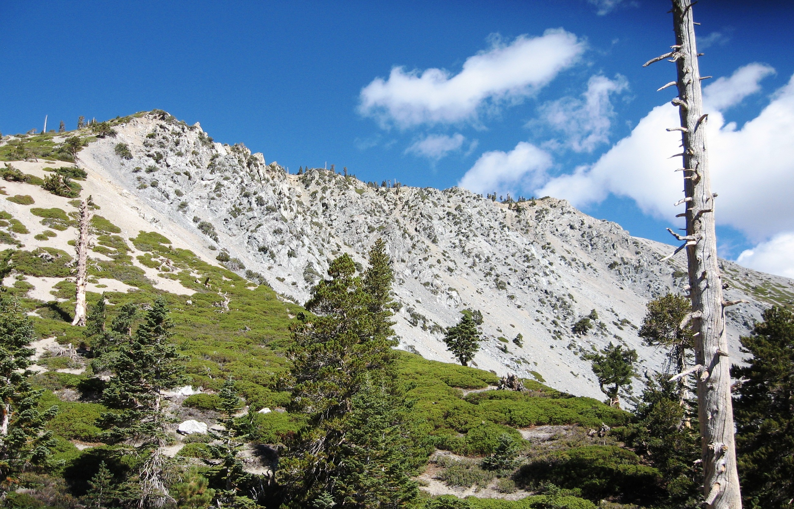
 Dry Lake The views of the surrounding snow covered peaks were beautiful. Just think, three members of our party were attempting to get to the top of Mt. San Gorgonio.
 San Gorgonio, Jepson and Charlton peaks Because there was time to burn, I did a little more hiking. My first stop was Lodgepole Spring. The water that comes from the spring travels to Dry Lake and disappears back into the ground before it makes it to the lake. As for Dry Lake, as the year wears on, it to will disappear for the most part.
 Lodgepole Spring From Lodgepole Spring, I continued hiking up towards Fish Creek Saddle. I was going to go to the top of Lake Peak but I thought better of the time. I returned to camp to find that two of our party had hit the trail back down. Bret was there resting and we decided to head back as well.
 Below Lake Peak adn above Dry Lake with Jepson Peak in the background With about an hour left in our trip back down the last three in our group caught up to us. They had made it up to the peak of San Gorgonio. It was difficult for them as they climbed up. The highlight was the descent. They got to slide on their backsides for about a thousand feet making for a quick descent. Being an average of twenty years younger helps getting to the top of the peak and getting down as well.
We all made it safely to the cars and off to A&W for a root-beer float. It was then off to home for a nice Saturday evening.
I have not jogged in a couple of weeks. I have been hiking on the weekends and will be backpacking again this weekend. I thought i would go for a jog tonight to get a little more exercise. I was pleasantly surprised to see that I beat my old time by about 20 seconds. It is not much, but it is in the right direction.
 Buena Vista trail in the evening
Jacob and I set out on an adventure with another troop in the area that is going to Philmont Scout Ranch the same week as we are. It was their maiden voyage of sorts, the first training backpacking trip for the group. We meet at the Forsee Creek Trail head in the where we began our adventure in search of John’s Meadow.
As with all Friday evening backpacking trips, natural light does not last long. We got started up the trail at 6:30, which was later than we wanted to.
 At the trail head The air was cool and the trail was a little steep. It was actually a very nice evening for backpacking in. As we were hiking, Jacob took some shots of the sun going down. In return I took some shots of him. It is rare to get pictures of Jacob. Then again, it is rare to get pictures of me because I am usually taking the pictures.
 The setting sun In no time, the sun faded and Jacob was taking pictures again.
 Fading light We were still marching on in darkness.
 Crossing a Cienaga Creek after dark We had been on the trail over three hours and we came to some peculiar obstacles. The trees that had fallen down over the trail that we had crossed were a small problem. However, snow patches on the trail that were becoming larger were looking problematic. Coupled with the fact we seemed to be gaining in elevation. I had the inclination that we had continued on the Foresee trail without making the 90 degree turn to John’s Meadow near the beginning of the trip.
The group was called to a halt and we reviewed the map. I looked at a map and brought up Google Maps on my phone as the other leader brought up the altitude on his GPS. We were on a trail and our elevation was 8600. The place that Google maps put us was directly south of a peculiar bend in Highway 38. The only way both of those could happen is if we were on the Foresee Trail and not the trail to John’s Meadow. Additionally, with the given time, we should have been close to arriving at John’s Meadow.
It was obvious continuing would not be a good decision. We were not on a snow camp out nor did we desire to make this trip one. We turned around and headed down the hill to find a place to sleep for the night. After 5 hours on the trail we made camp at 11:30 PM. We had traveled better than 3 miles up and two plus miles back. Jacob and I had a cliff bar each, threw down a ground cloth, used two hiking poles and a heavy duty space blanket to make a canopy and we summarily crashed.
 Hotel San Gorgonio Bright and early the next morning my alarm went off at 6:00 AM. I got up and surveyed the scene. We decided to strike camp and head back to the trail head to cook breakfast.
 A new day is upon us We had to wait a few minutes for everyone to get packed up and Jacob used it to text some people.

Breakfast was good. We took time to reflect on the events of the evening and also teach the young men a little more on gear and packing a backpack. We then packed the vehicles and headed to A&W for a burger and a root beer float.
At first look, it was an un-Forsee-able turn of events. However, overall the trip it did exactly what a training outing should be – a not perfect event that allows young men to learn in a safe environment. They all learned that they need to pay attention to where they are and know where they are going. We all will be better prepared for the next adventure.
Eric has a job. He has finished his training at Smart and Final and is now a contributing member of society. He has to go to work early some days, 6 AM and stays late some days, 9PM. It is a intriguing feeling to “sleep in” to 6:00 AM knowing that Eric is already at work. I had to stop by today and take his picture at work. When I got there, he was just going on break. He was out of money as he has not received a pay check. I gave him a couple of bucks so he could get something to drink. His favorite is the half gallon of lemon-aid for $1.69. Soon he will use his own bucks for lemon-aid.
 Working Man
Today was a training hike to prepare the scouts for a Trek at Philmont Scout Ranch this summer. The hikers were Emily and Walter along with Scouts Trevor and Brandon. The plan was to take the Two Trees Trail up to the road and follow that to Box Springs Lookout. From there we would backtrack to the road that heads west and follow it until we met the power lines. Along the power lines is the the Edison trail. From there we would catch the trail down to the “C” and then make our descent and make our way to the Two Trees Trail head.
Emily made sure I was in front to get through the area where we saw the snake last week Once we were past that spot she lead the way. She was kind enough to stop every once in a while to let me catch up. One of the stops was Cassina Springs.
 Cassina Springs As we were resting we heard “clear the trail” coming from down the trail. We looked down the trail and moved to clear it as some old man came running up the trail wearing very short running shorts. Emily who was still sitting commented, “I think I just saw more hairy thigh than I ever wanted to.”
We made out way to the top of the trail and headed out on the road. As planned we made it to the junction of the road that heads east and one that heads west. We chose to keep heading East. We were going to try to find the M. While at the junction I had the scouts find where we were on the map. I tested them a couple of times and they did well.
 Map reading We made it to the Box Springs Lookout which gave us a view towards the south. We had traveled over 4 miles and the option was, do we go find the M or head west towards the trail head. The scouts chose to head back. We made our way back and then caught the road that headed west. We followed it to the end and then looked for the “Edison Trail” which was very difficult to find. We had walked past were the trail met the road and needed to go cross country to get to the trail.
We got on the trail, a trail that I was told really was not a trail, but possibly once was a trail. You could see that there was a trail there, but there was a lot of grass on the trail with those pesky fox tails. I led the way and was told by one young man that if he got bit by a snake I would have to pay for it. We did not see any snakes, only a few lizards and lots of fax tails. We took a break at the end of the “Not a trail Edison Trail” to remove the fox tails.
 Not a trail Edison Trail that follows the power poles You can click on the pictures to make them bigger. You will notice the “green” grasses along the trail as it goes up the hill along the “not a trail Edison Trail.” We were soon on the trail that leads down to the C. At first there was some desire to go down the road that met the place we were. Once everyone could see that it was a trail as opposed to not a trail trail, they were good to go. I wondered where the sense of adventure was.
We trekked on and came to a spot where the trail started to descend. Of course it was a place to take a picture.
 No C yet Soon enough we sighted the C and quickly made our way to it. We had also passed the 6 mile mark as we came closer to the C.
 See the C or C the C? Once there we tightened our boots as the descent was fairly steep. There were those that preferred a different method of decent contrary to hiking down a trail.
 See us slice or C us slide? Soon enough we were making our way back to the truck. I did slip going down the hill and broke one of my hiking poles. Better to break a pole that get hurt. Overall the hike was a good exercise. I did not mind the unimproved trail and fox tails can be pulled out. The hike was 7.6 miles long and took us 3 hours and fifty minutes to complete.
 Two Trees Trail to Box Springs Lookout and they past the C  Almost 2000 feet of elevation gain
I decided to step it up and start running. I am not getting enough exercise by just walking 4 to 5 miles a couple of times a week. When I go hiking up a steep grade I still get a little winded, especially when chasing children.
Monday night Eric and I ran and walked a route to the base of Mt. Rubidoux where we jogged and mostly walked up the Buena Vista Trail. We come out on the up road and then go back down the 9th Street Trail. The route is 2.5 miles long and has an elevation gain of 200 feet. Monday, the time was 33:48 and tonight we shave off two minutes for a time of 31:46. I guess an evening run for a couple of miles with a pace of 12.7 minutes per mile is acceptable for a beginning spot.
I just need to figure out how to gain speed for the 215 feet of elevation gain in the distance of quarter mile as we go up the Buena Vista Trail. That is about 16 percent grade for a quarter mile.
 9th Street Trail by twilight
I invited Emily to go on a short hike today with Jacob and me up the Two Trees Trail in the Box Springs Mountain Park. We made out way to the trail head parking and Emily started up her phone application to track the exercise. She asked if we were ready and I said yes. We then heard, 5, 4, 3, 2, 1, free your endorphins. I thought, how warm and fuzzy. My tracking application just beeps when it is started.
Our first ship was to adjust our hiking poles and read the sighs at the trail head. We got the Mountain Lion warning. I was surprised that there was no snake warning. We have traveled about 100 feet and laying across the trail was a large snake. It started to move off the trail and as its head disappeared into the bushes its tail soon appeared. No rattles was a good sign as it probably was a gopher snake.
We headed up the trail and took a break at a shady spot. I was surprised that there was green vegetation with all the warm weather we have been having.

A little further up the trail we heard water and found a surprise. There was a spring, Cassina Springs. The spring is named after a woman from Italy that purchased the land in 1927.
 Cassina Springs Emily told us that she was out of shape and thought she would have difficulty making it up the trail. Soon enough she was leading the way and then she was starting to disappear. Jacob was tired because he stayed up late the night before.

We made it to end of the trail where it meets the road at the top of Box Springs Mountain. As we sat there was a light breeze that felt great.
 Emily and Jacob resting at the end of the Two Trees trail Then it was back down the trail. The peak in front of us it Sugarloaf Mountain that we climbed two weeks ago.

The Two Trees Trail round trip is about 3 miles and has an elevation gain of about 1200 feet. It was a good Saturday morning exercise.
I really did not know how to title this one. Perhaps “Double Sunset” would have worked. The first possible sunset could be considered when opossum number two left this earthly existence early this morning. It has only been a couple of weeks from the time opossum number one was found dead on the concrete in the back yard. There were four opossums before that got stuck in a trash can and got a free ride to the park.
Now for sunset two for the day. It was a warm day here, or should I say hot because it was in the 90’s. I needed to walk so I left later this evening. I did about three miles with a 500 foot elevation gain in about an hour. My legs are a little sore. This Saturday may be a two hour or more hike with a 1200 foot elevation gain in just over three miles. More than twice the elevation gain in slightly more mileage. Sounds fun . . . As for this evenings hike, the picture.
 Sunset from close to the top of Mt Rubidoux
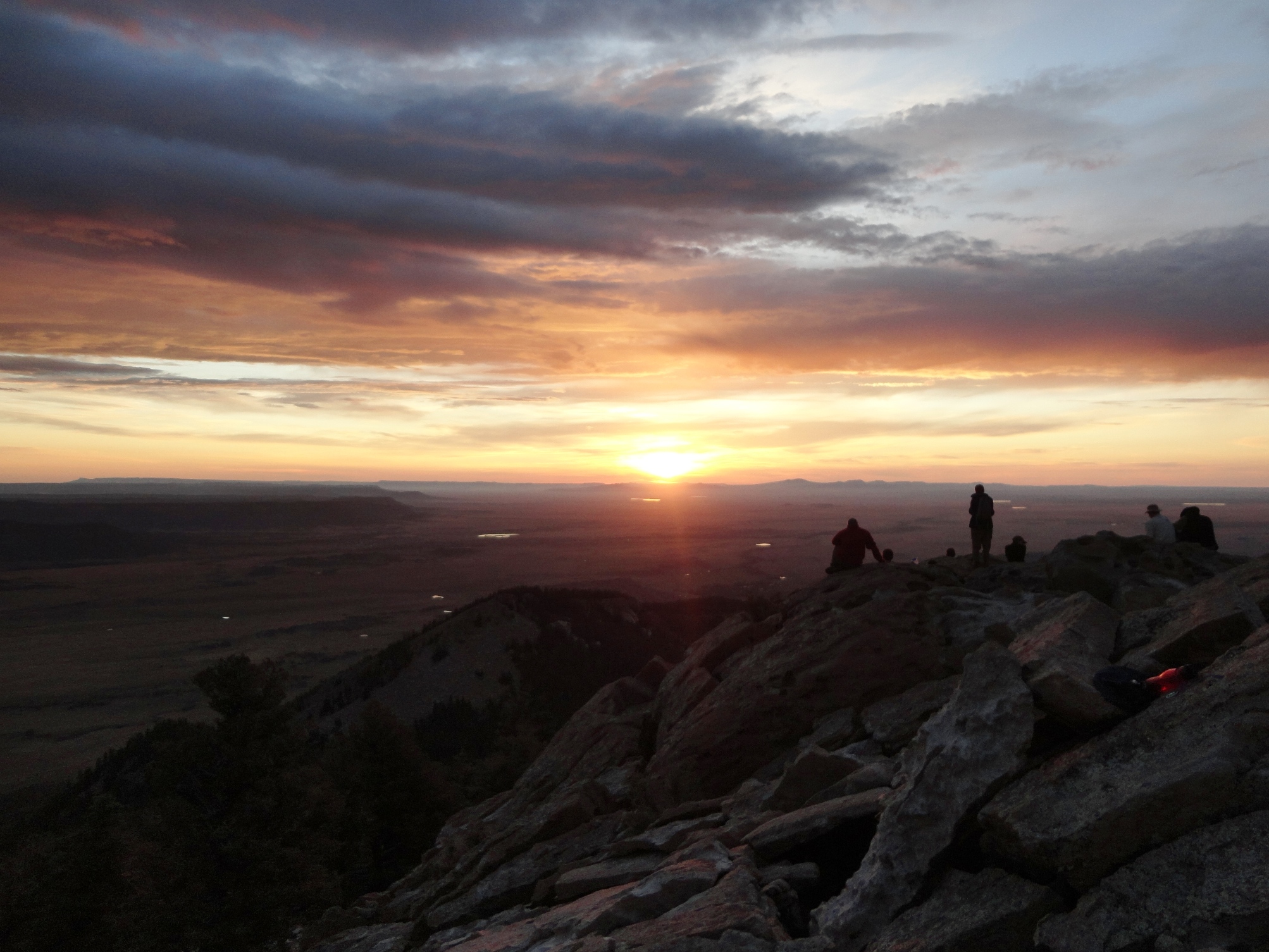
This evening it started to cool do so I felt like going out for a walk. I did not intend to walk very far, but I was enjoying the light breeze of the evening. I meandered us Mt. Rubidoux as the sun was getting low in the western sky. I was a little intrigued that there seemed to be several people that were finding spots on boulders and rocks to watch the sun go down. I was facing East thinking about how tomorrow the sun would come up to brighten the day.
After a short break and a bottle of water I began the walk down. I did not have to wait as long as I was descending the sun was as well. I wanted to make it home before twilight’s end. I got home as darkens began to settle in. Here I will await the rising of the sun in the East to bring brightness to the day.
 Sunset on Mt Rubidoux
Wanted to go to the shooting range today because there was nothing on the calendar on the sportsmen’s club website. I needed to take a buddy so I sent Emily a text to see if she wanted to go. She did and was here at 8 in the morning to make the trip. I was surprised to see the gate open. When we arrived, a lady cam over to tell me the range was closed due to the Ladies Shoot. I asked if it would be alright if my daughter participated. The answer was yes.
Emily had a safety briefing before she went to the firing line. First she shot a Browning semiautomatic in 9 mm. Most of the ladies were shooting .22 rim-fire pistols. Emily’s first pull of the trigger and she jumped. It was louder than she expected. After several rounds downrange her groups began to tighten up a bit. I just sat there an kept quiet as there was plenty of experienced help to give Emily guidance.
Next on the agenda was some .38 special trough a revolver. She shot several rounds and then took a break.

Emily then had the opportunity to shoot some .22 rim-fire. She had a coach sitting next to her as her groups tightened up even more. I went to the lower range and sent some lead into paper and returned to find Emily still sitting there trying to keep all her shots the a 2 inch circle. Ten by ten she kept going. Up until about the last second before we had to leave so she could get to work, she kept sending lead downrange.

I thought the day was gong to be a bust due to a activity at the range. As it was, Emily really enjoined herself and she wants to go back soon.
Today we went on a hike in preparation for our Philmont Trek this summer. As with any hike one need to plan and prepare. Part of the planning is to see if there are any geocaches available on the hike. We met at 7:00 in the neighborhood near the base of Sugarloaf Mountain in Riverside. We started our hike at about 1,200 ft.
 Leaving the Blaine Street Park We made our way up towards the peak. When close to the peak we found a geocache, Sweet Tooth – GC3930
After finding the geocache we made out way to the peak, 1,944 ft. In that area we found another geocache Happy Birthday Honey – GCDEAD
 On top of Sugarloaf Of course we did not go down the way we came up. We hiked down the north side down to an elevation of about 1,000 ft. and then to the west and around the mountain back to where we started.
 Jacob and the other crew members on the way down from Sugarloaf With today’s technology, you can see the route and the elevation. It was a fun hike. There are more geocaches in the are that need to be found.


Today I had to go in to LA for a meeting so I decided to take the train. It was an interesting adventure. The first stop was the ticket machine. There was no real sign on how to get started, just some buttons. I had to ask the person next to me what to do. Little did I know that the screen lit up when you pressed any button. Once there was something on the screen, I realized it was a touch screen and the choices were simple.
The meeting went well and I had time to get something to eat. A quick walk across the street from Union Station is Olvera Street. I have eaten at Roldolf’s on Olvera Street before so I know where to go. Breakfast was over, but they let me choose off the breakfast menu so I had Machaca.
 Machaca on Olvera Street The food was good and watching the tourists and school children pass by was entertaining. I looked back on a time when I was in the LA area and Eric had a field trip to Olvera Street. To his surprise I met him there. As I finished up lunch I had a small visitor.
 Lunch Guest It was then back to Union Station to board the train for the return trip. Overall, it was much easier than driving.
Tonight as I was wrapping things up at work Scott called and used his famous line, “Where are you at?” Of course I was at work. His next line surprised me, “Do you want to go sailing?” It was time to go home so I made my way home to get Scott to go sailing.
When I got home he was a little unsure if he wanted to go sailing. I just said,” We are going, so let’s go.” Scoot just followed and we made our way down to the park and put a couple of boats into the water. We got in and I sailed next to him coaching him. We made our way across the lake to the other side. Once there we needed to turn the other direction. After a couple of tries Scott and I were headed back the other direction.

Scott got pretty good and maneuvering the little Sabot around the lake. When we were done, I asked him how he liked it. Is response, “It was too much work.”

|
Copyright Notice © gdpalmer, 2008-2021. Unauthorized use and/or duplication of this material without express and written permission from this blog’s author and/or owner is strictly prohibited. Excerpts and links may be used, provided that full and clear credit is given to gdpalmer with appropriate and specific direction to the original content.
|